I climbed to it with my son in 2012, I sent friends there in 2013 and I longed to return this year. Based on our experience hiking around 10,000 ft. there was still a lot of snow until late June, as the winter had had 120% of normal snowfall. On June 27th Mandy and I figured we’d head down to Silverton, camp in the South Mineral Creek campground, and make for the basin.
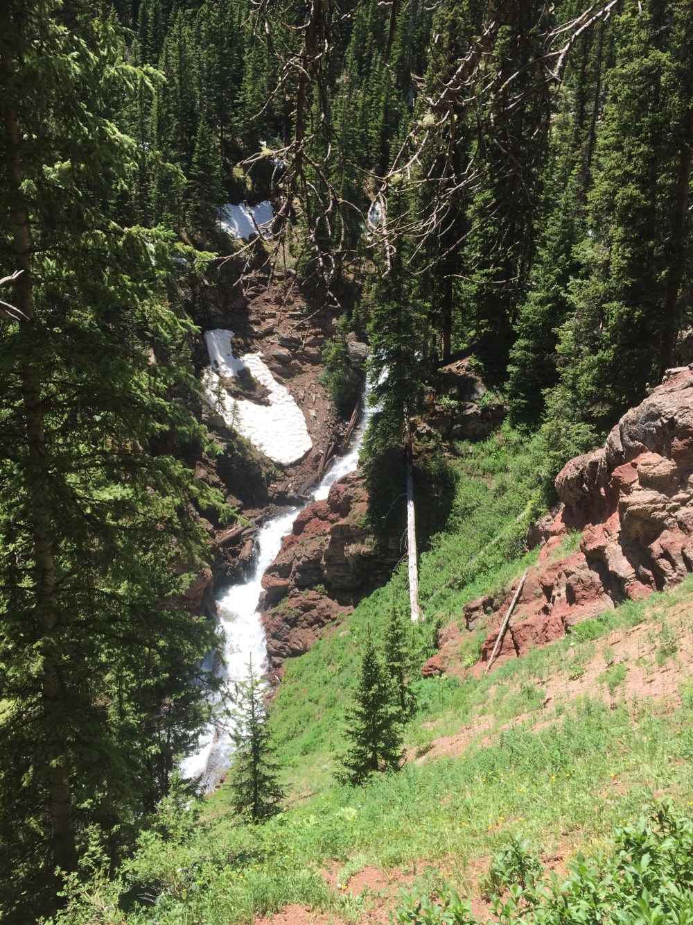
The hike starting out was harder than I remembered, as you are already at 9,500 ft., so we were huffing and puffing to get started. I remembered the famous last leg toward the basin as being where I had had the most trouble breathing previously. The trail zig zags through the lower forest with a waterfall in and out of view. The trail used to cut across a wooden bridge near the top of the waterfall, but it has since washed out.


After emerging from the forest, the trail cuts through a series of alpine meadows that are beautiful enough to take your breath away. It was still a little early for the well-known blankets of wildflowers, but there were a few popping their heads out, including this beautiful Colorado Columbine.
The last meadow before the surge for the basin is 180 degrees of snow-covered cliffs with waterfalls everywhere emerging from the snow. I tried to capture a video but it doesn’t really do it justice, although you can hear the roaring of the waterfalls.
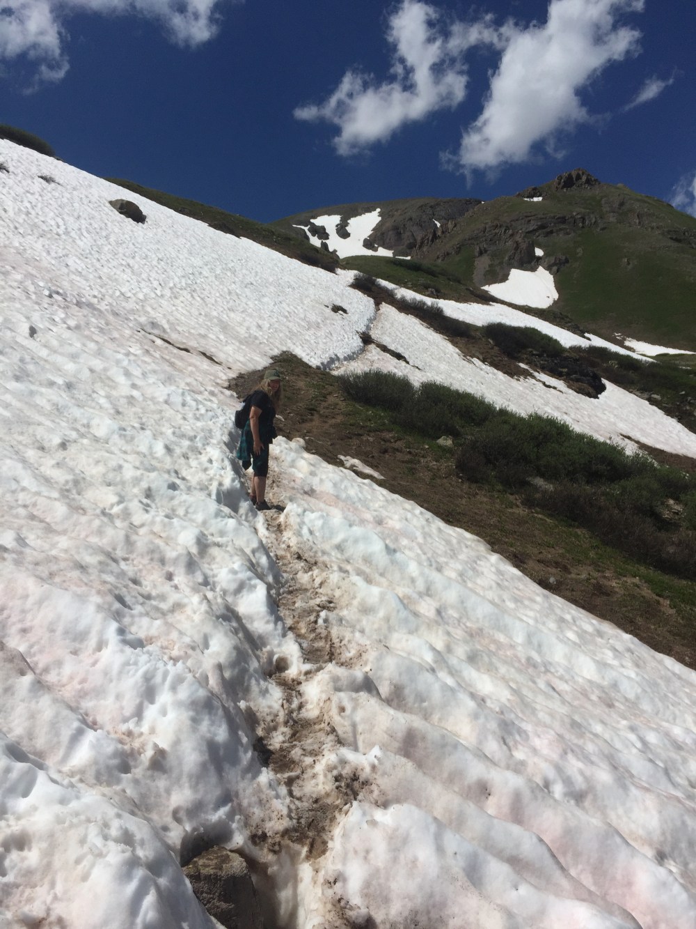
The first major hurdle was one of the creeks that was not easily crossable, as it was swollen with snowmelt. You could either take off your shoes and wade through the thigh-deep, ice cold rushing water, or you could walk 100 yards up the creek to an “ice bridge,” as a fellow hiker giving us advice called it. We opted for the latter. There were indeed footprints going across the bridge with the swollen stream crashing underneath. We decided to go for it, hoping that we wouldn’t be the unlucky hiker that the “bridge” decided to cave in on. Next came the really hard part – the final push to the top. Keep in mind that you are laboring at 12,000 feet above sea level on a steep trail going up the side of a mountain. Exacerbating this is the fact that lots of the trail was still occluded by snow. The going got a little treacherous through the snow banks, as one little slip could send you down the mountain on your behind. If you kept your mind on the trail and put one foot in front of the other on the previous hikers’ footsteps you were likely to be okay.
We weren’t at all prepared for what came next. Instead of this:
We found this:


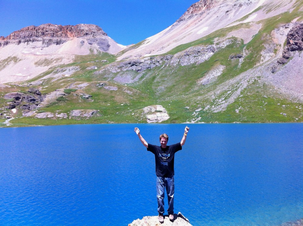
What a difference a little extra snowfall can make. The picture above was taken one week earlier, in 2012! The entire basin this year was filled was snow and the lake, although showing around the edges, was still mostly frozen solid. Mandy kept saying “where’s that azure lake I hiked up here for!” The vista made for a good trade off, however.
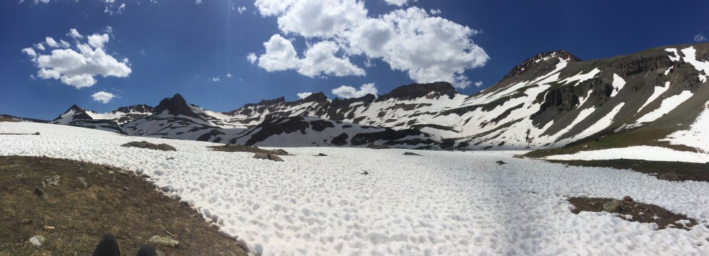
The 12,500 ft. basin is surrounded by 13’ers such as Vermillion Peak, Golden Horn, Pilot Knob and US Grant Peak. Absolutely stunning. There are side trips to Fuller Lake and Island Lake, all easy side trips except for one thing; the deep snow hiding the trail.
We made friends with a pair of local marmots on the way back down. At least we like to think so!

The entire trip was 22,299 steps or 7.7 miles and took us 5 hours to complete.

