
I have been coming to the San Juan Mountains since I was 4-years-old. Our first trips as a family to the San Juans began at the S-Lazy-U Dude Ranch between Creede and Lake City, on the headwaters of the Rio Grande. My dad used to fly fish while my mom and sister and I would dam streams, harass weasels that were trying to dine on chipmunks, and hike up to ghost cabins. We would always rent a jeep in Lake City and do the alpine loop over Cinnamon and Engineer Pass. I remember my mother and sister jumping out of the jeep as my dad struggled to keep the jeep moving onward and upward on some of the steep switchbacks. I think he could have used a lesson on a standard transmission in the mountains before heading out!
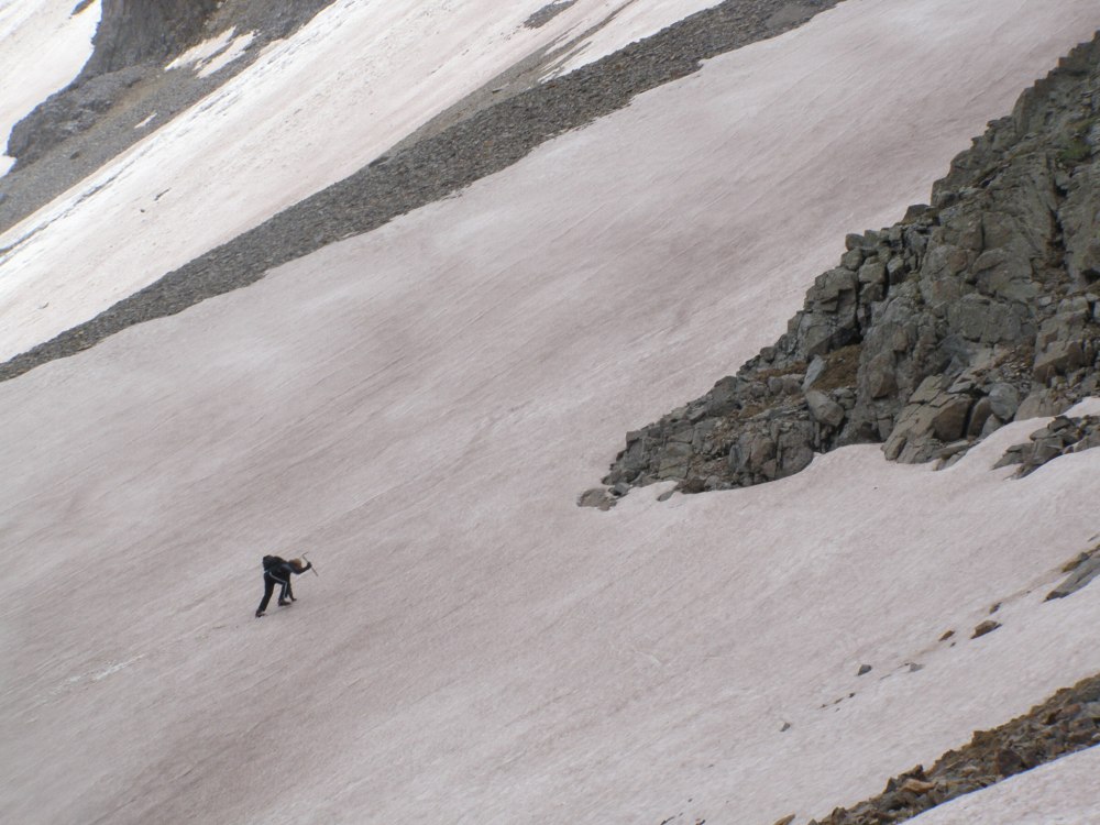
I feel like the mountains are part of me. A piece of my soul resides here in the San Juans, and I always feel happier and more whole when I am here, and yearn to return when I am not. Fast forward from 1968 to 2004 and you will find me solo-adventuring on my first return trip as an adult to my beloved mountains. I actually made two trips up in 2004, one trip ostensibly to deliver an architectural model that Mandy had built of a new $3 million dollar “cabin” in Telluride. The builder paid me enough for the gas, but it was worth it. On my return visit, around September 8th, 2004, a Pacific front dumped a foot of snow on the mountains above 10,000 feet. I had to wait a couple days, but I soon made my bid to bag my first 14’er: Mt. Handies. It was a tough climb for me, even though it is a walk-up 14’er. I wasn’t well acclimated and every step was a struggle. The last 500 feet to the summit were the worst. At the top I met two cool Californians who had actually climbed over an unmarked route crossing a 12,000 ft. ridge from Highway 550 between Durango and Silverton to make their ascent of Handies. We shared some good political talk and laughs and I bid them farewell, but I keep up with their climbs on summitpost.org, which is a wonderful website for researching mountains and rocks worldwide and the most favorable routes to climb them for your skill level. Here is a great photo of them making their way down the mountain. The basin of mountains covered in snow in the background, looking south from Handies toward Mt. Eolus on summitpost.org (a mountain hosted by “Diggler”, one of the guys I met on Handies) and Red Mountain is the largest contiguous area over 12,000 feet in the United States. In the foreground are from left, American Peak, Niagara Peak and Jones Mountain. Sloan Lake is in the center foreground.

The Californians told me they had made a bid for the summit of Mt. Sneffels, another 14’er about 10 miles due west of Handies in the Sneffels Wilderness about 2 days prior, but that there was too much snow to reach the summit. I decided to try, since the days were warming and the snow was melting. I made it to what I thought was the summit of Mt. Sneffels, even though I had a sneaking suspicion that the rock mass to my left had to be climbed to truly reach the pinnacle of Sneffels. I couldn’t find a way up, and I was alone, so I chose to leave the mountain, in one piece.
In 2010 my son was old enough to bring to Colorado for some climbing and adventure. We too made a bid for Mt. Sneffels’ summit in early June, but there was a lot of snow and the signs pointing the way to the summit were buried. I made the mistake of thinking 13,694 ft. Gilpin Peak was Sneffels, so we climbed that by mistake! We were about 1,000 feet from the summit when a peal of thunder struck fear in us. We did an about face and hustled down the mountain as fast as we could with the thunder increasing in frequency and decreasing in distance as we went. I was quite scared, but we made it to the jeep just as the sleet hit, and we drove/slid our way back down the high jeep trail to safety.
Levar and I decided to try again for the right mountain this time in 2012, on Levar’s 17th birthday, June 26th.. We made the false summit successfully after climbing the Lavender Couloir and followed others up a narrow V-notch to the true summit. To get to the V-notch you kind of had to hoist yourself over a piece of missing mountain to gain a foothold.


A wrong step and you would find yourself tumbling thousands of feet! Levar helped me up into the V-notch, which once you had a good foothold was pretty simple to ascend. It was only 20 vertical feet or so in the V-notch and you emerged on a narrow ledge that lead to a wide enough area on the summit for a dozen or so people to comfortably hang out. My back decided to go out while getting to the summit, so you can see in the photo that I am slightly hunched!

Somehow, despite my back problems, we made it back down Sneffels, with me taking it slow and easy, one step at a time, and Levar jumping and sliding much of the way down the 1,000 ft. scree slope.

Other highlights from our trip included a jeep trip over some of the same trails my Dad used to take, but adding to that, some more extreme passes such as Ophir and Imogene and some of the infamous routes such as California and Corkscrew Gulch.


After Sneffels, Levar and I high-camped at Alta Lakes above Telluride’s Mountain Village, at 11,000 feet. We had a nice fire and some stories and bedded down. When I opened the tent in the morning I spied to artists painting a nearby peak. Turns out it was the Telluride Plein Air Art Festival, and the artists were dispersed throughout the Telluride region over the course of a week. They were supposed to come together over the weekend in Telluride to display and sell their work. I don’t know if it was really kosher or not, but I shortened that process by negotiating with the artists on the spot. The woman was asking too much, saying what her work would go for in a gallery, but the gentleman offered his work to me for half that cost. I’m happy to say that the painting now graces Levar’s bedroom wall, but unhappy to say that I don’t remember the artist’s name! The painting is not signed anywhere. Perhaps I will run into him again someday and see if he remembers me. Both artists were working on paintings of Silver Mountain. Here is a peak at the work in progress and the actual subject.


I think he did pretty well, in the plein air style of painting. Levar and I also got some mountain biking in on the high trails, as well as messing around on some of the boulders overlooking Telluride.


Now, in 2016 and 2017 Mandy and I have been camp hosts at Ridgway State Park. We get Tuesdays and Wednesdays off, and haven’t wasted any time in getting out to explore. There are wonderful trails around Ouray and Telluride and we’ve hit several already, even though there is still plenty of snow at the higher elevations. An early-season favorite is the Ouray Perimeter Trail, which features gorgeous mountain scenery, close-up views of Cascade Falls and some modest challenges on the trail itself.


One of our favorites recent forays is the Weehawken Trail, which is accessed on CR 361, the Camp Bird Mine Road, just above Ouray to the south off Hwy 550 headed toward Silverton. Instead of hiking the entire Weehawken Trail, we took a righthand spur that leads to the Alpine Mine lookout. The view from the lookout is marvelous, taking in most of Hayden Mountain and United States Mountain.

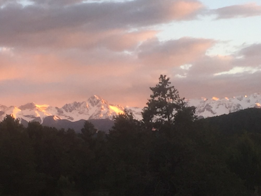
I will close with some more shots of my beloved Mt. Sneffels with varying amounts of snow and during different times of day. These are all views from the north side, where Ridgway State Park lies.


